
These are some of the panoramic sights you can see when you get to the top of T-Hill.
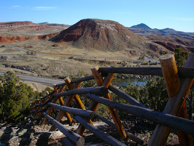
This is the view of the Buffalo Pasture and Monument Hill, the north end of Hot Springs State Park (facing east).
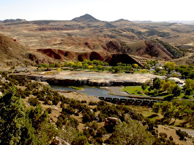
 Below is the view of the south end of the state park. Note the coal cars passing on the tracks which follow the river valley.
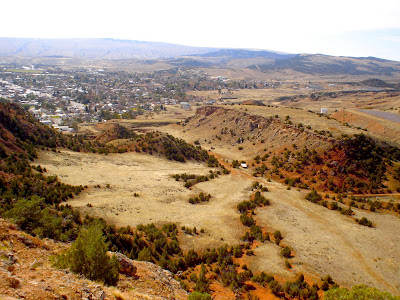
 Below is Witt Field with the baseball diamonds, and behind that is the County State Fair grounds (facing south). Here is where people come on the night of July 4th to see the fireworks display since it is at the top of T-Hill where they are set off.
 The photograph above was taken from the edge of the T-Hill plateau as seen in the photograph below (the shot was taken from Monument Hill).

 In the distance (below, facing west) is Roundtop mountain, and at its base is Monument Hill Cemetery on the left and Legion Town and Country Club golf course on the right. The ridge in the foreground is part of King-Spiller Nature Center which has a path leading to its point from the plateau of T-Hill.
 Next to the golf course is the airport.
 The scenery looking north:
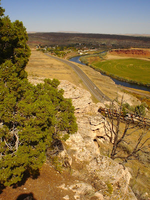
 A panoramic view of highway US 20 and the Bighorn River, looking north.
 See also T-Hill hike, part 2, part 1.
 Below is the view of the south end of the state park. Note the coal cars passing on the tracks which follow the river valley.
 Below is Witt Field with the baseball diamonds, and behind that is the County State Fair grounds (facing south). Here is where people come on the night of July 4th to see the fireworks display since it is at the top of T-Hill where they are set off.
 The photograph above was taken from the edge of the T-Hill plateau as seen in the photograph below (the shot was taken from Monument Hill).
Looking southwest is the King-Spiller Nature Center.

 In the distance (below, facing west) is Roundtop mountain, and at its base is Monument Hill Cemetery on the left and Legion Town and Country Club golf course on the right. The ridge in the foreground is part of King-Spiller Nature Center which has a path leading to its point from the plateau of T-Hill.
 Next to the golf course is the airport.
 The scenery looking north:
 A panoramic view of highway US 20 and the Bighorn River, looking north.
 See also T-Hill hike, part 2, part 1.
See also Star Trail hike.
See also Owl Creek Hill Road hike, part 2, part 1.link: index to photographs

No comments:
Post a Comment